Operations Platform

The VI Platform™

Learn More

One central hub for managing drone operations.

Simplified

Eliminate dangerous and repetitive tasks with streamlined operational workflows.

Centralized

Establish a single source of truth for stakeholders to access up-to-date asset information.

Standardized

Consistently reproduce asset data, regardless of the operator, aircraft or location.
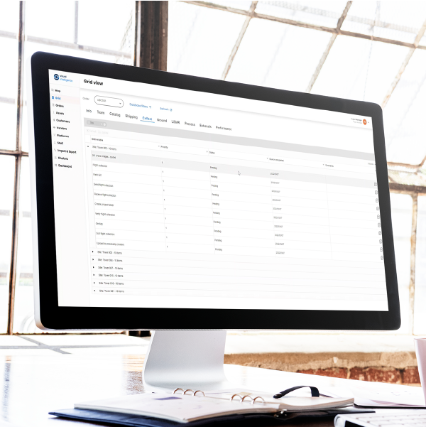
The VI Platform™

A unified platform for drone operations and dataflow management.

A unified, end-to-end system for managing enterprise drone operations and automating the collection, processing, and delivery process. It provides a central portal and tools to manage pilots, dispatch tower captures, QA data collection, upload data and more.

Download PDF

A suite of apps to help manage drone collections

MANAGE

VI Web Portal

A portal for requesting, monitoring, and managing tower site collections.

COLLECT

VI Autonav

Autonomous drone flight mission planning for consistent, repeatable captures.

COLLECT

VI Payload Module™

An app that configures the MACS-3D™ payload for capture based on collection parameters.

VERIFY

VI QA/QC

A tool for verification of tower data collection while the operator is still onsite and in the field.

PROCESS

VI Monitor

A module for managing the movement of large amounts of 3d tower data.

PROCESS

VI Geotag

An app for geotagging drone imagery for hyper-accurate geospatial information.

Automation unlocks enterprise scale.

To unlock repeatable datasets at previously impossible scale, we automate nearly every facet in the asset insight supply chain. Manage pilots, check equipment, dispatch captures, upload data and more – all from one central portal.

3D Dataflow

VI Platform

1

Inquiry

2

Plan

3

Dispatch

4

Capture

5

Ingest

6

Transform

Asset site captures are requested.

Site-specific missions are planned.

Operators are scheduled for captures.

Drone missions are fully autonomous.

Sensor data is uploaded to the platform.

Asset data is prepared for 3D modeling.

Analytics

Digital Twin

7

Analyze

8

Insight

3D modeling and AI analysis is performed.

Engineering- grade insights are delivered.

Other products

Sensor

Patented dual-sensor drone technology created to deliver millimeter-class data and near-complete surface coverage.

Analytics

Innovative digital twin engines to visualize, inspect, plan, and analyze towers in a 3D collaborative environment.

Services

Fully delivered site drawings, mapping, reports, and analysis generated from Engineering Class drone data.

Ready to get started?

Discover how a new class of digital twin will transform your enterprise.

Talk to an expert.

Let us know what interests you and we’ll get back to you asap.

Get in touch

Request a demo.

Request a demonstration of our technology and capabilities.

Request a demo

Download Guide.

Download our FREE guide that explains why Millimeters Matter™.

Download Guide